Innovating AgTech Bonus Episode Transcript
What will agriculture be like in 100 years?
[Theme Music plays]
Hannah Senior: When I was recording the Innovating AgTech documentary, I finished
most of my interviews by asking what agriculture would be like in 100 years time. When
we’re talking about AgTech, we’re talking about steering a course to the future, a
collective active imagination about how things could be. My guests came from all over
the world, many areas of food and agriculture, and so the answers were illuminating.
This bonus podcast is to share some of those answers that I heard, and I hope you’ll
find them as interesting as I did.
[Theme Music plays]
Hannah Senior: Andrew Todd’s farm, in Australia’s wheatbelt, has been in his family for
generations. So, he pondered the future by reflecting on the past.
Andrew Todd: My grandfather’s still on this earth. He’s 92 and I don’t really think I know
anyone more passionate about agriculture. And he keeps up to date. He reads every
paper, he listens to the radio. Anything agriculture, he just lives and breathes it, right?
So, I can talk to him about drones and swarm bots.
Andrew Todd: The other day, I was talking to him about… On our harvester now,
another thing that we’ve added to it, it hasn’t got enough bells and whistles on it, we’ve
added a new infrared analysis machine so we can have on the go, as well as yield
mapping, we can map protein, moisture, in canola. We map oil colour as well. So, in
barley we have colour. So, I was explaining to him, “Oh, yeah, we can manage the
logistics of grain quality in the paddock, because I know what it is as it’s coming into the
harvester.” And that sort of thing just blows his mind.
Andrew Todd: He said to me, “Well, I can remember walking home in the dark two
miles, from a night on the harvester when I was 13 years old, to tell my grandfather that
I’d harvested a hundred bags of wheat for the day because it was the first time I’d ever
done it.” And we do a hundred bags in under an hour. So, when you ask me that
question, I think God, look at what’s changed in his lifetime. I wouldn’t have a clue. He
could not have imagined those things. So, I think I’m thinking out there when I say, “Oh,
there’ll be a lot of robots, there’ll be swarms. There’ll be less people and more small
machines and technology is the obvious answer, isn’t it?” But what that looks like I don’t
know because what I’m talking to you about, we can already see, that’s already here. It
just isn’t widely adopted. So, that answer’s going to cover 20 years. One hundred? I
have no idea!
Hannah Senior: Sarah Nolet, the CEO and founder of AgThentic and partner at
Tenacious Ventures, has mixed feelings about the future but she hopes that new ways
of thinking will light the path towards sustainable agricultural practices.
Sarah Nolet: Oh my gosh, this is such a terrifying question. I’m very worried about
what… I mean the planet will be okay, the rock will still be here, but the humans and the
animals are, I think, in pretty big trouble. So, I expect we will see growing different
things in very different places. We’ll see a lot more controlled environment. I think the
way we farm and think about food will have to be really different. I try to be optimistic,
I’m a little bit of a pessimist maybe by nature. But when I think optimistically, there’s a
real potential for agriculture to be part of the solution to many of these problems through
how we manage our land, how we manage our water, and opportunities to sequester
carbon. Absolutely the time is now, and we need to act on that.
Sarah Nolet: That’s new business models, new ways of thinking, new technologies,
new policies. Actually, I shouldn’t say new technologies. We really do have all of the
technologies we need. It’s truly a human coordination challenge at this point. I hope that
in a hundred years we look back and say, “Wow, I’m so glad we recognized the role that
agriculture and land management had to play, and got our act together to enable that to
be true, and helped find ways to make farms sustainable and profitable and providing
Innovating
AgTech Bonus Episode Transcript
Page 2 of 16
What
will agriculture be like in 100 years?
food for our growing population.” I don’t really think we have a choice and so I think
that’s a bright future for agriculture, because it is a unique opportunity than other sectors
that really only are part of the problem, not able to be part of the solution.
Hannah Senior: Craige McKenzie, a precision agriculture specialist and farmer in New
Zealand, considers access to water and continued advancement in AgTech as two key
factors for securing our global future.
Craige McKenzie: What were we doing a hundred years ago, you know? We were just
getting tractors. Who was thinking about GPS, there’s a few stars in the sky but not too
many satellites. So, how do we view that? What we know is climate is changing. People
have to adapt. We’ll be growing different crops in different areas, under the current
change that we’re seeing around the globe. We need to make sure that people are
upskilled in that situation and we need to be able to feed a growing population or
whatever the population looks like in a hundred years. If we don’t feed the population in
a hundred years, you’re going to have massive civil unrest and you’re going to have a
whole bunch of different problems.
Craige McKenzie: So, different problems, different challenges, different opportunities.
And technology. Goodness, who knows, look where we’ve come in 20 years, who
knows what we’re going to be doing. And there’s going to be autonomous vehicles, but
one of the things that may happen is we’ve got bigger and bigger vehicles and tractors
and whatever around the world, we may go the other way, where we’ve got small
autonomous vehicles, lighter footprint, a whole bunch of different things.
Craige McKenzie: But probably the biggest challenge globally is water. Doesn’t matter
whether it’s water quality, water quantity, too much, too little, wrong place, wrong time,
extreme events. It’s going to be the biggest challenge around the world.
Innovating
AgTech Bonus Episode Transcript
Page 3 of 16
What
will agriculture be like in 100 years?
Hannah Senior: Serial entrepreneur and food system investor, Peter Hertz grounded
his thoughts with the notion that 100 years is a blink of an eye for our planet. So,
humans should be humble in the face of nature’s long game.
Peter Hertz: I would say that the complexity of biological and human systems is
exceedingly high and I’m not optimistic that we are going to understand how all that
works in that time range. What we have to understand is our planet has evolved over
billions of years and my favourite line that I’ve heard from some entrepreneurs who
come to me and say, “Cows are inefficient.” Well, that’s a delightful statement to make
but cows have been around longer than you have and it’s very likely that evolution has
forced it to be quite efficient.
Peter Hertz: I am not expecting us to create a synthetic cow anytime soon that will
somehow deliver what we think the natural system does. What I would hope to see is a
food system that is actually grounded more in how natural systems already operate,
because the more we can align with nature, the more likely it’s going to work out in the
long run. And the more we decide, we know what we’re doing, the more often we’re
going to have unintended consequences. It may take us a while, but we’ll discover that
we’re killing people, and I’m sorry for the people that had to die in that process, but that
is the more dangerous path. What I would hope for in the hundred year timeline is a
food system that is aligned with how nature works. That would be my hope.
Hannah Senior: Daniel Zimmer, the Director of Sustainable Land Use at Climate-KIC,
echoed Peter Hertz’s thoughts of learning from nature in the next hundred years.
Hannah Senior: Predicting things is, of course, a very difficult exercise but obviously we
need to move toward much more agro-ecological principles. We need to learn from
nature and without more biodiversity in the soils, in particular, we will not be able to
function well. So, we need to reinvent completely our relation
with nature in the
agricultural sector and we need to do it particularly in our soils.
Innovating
AgTech Bonus Episode Transcript
Page 4 of 16
What
will agriculture be like in 100 years?
Daniel Zimmer: When I was a student, soils were just considered as a black box,
basically, and you put a lot of powder, fertilisers or treatments, et cetera. This needs to
be completely changed. We need to understand all the ecological principles that are
important for our production, but for our health as well. We have had the tendency to
create and to generate our food through practices that have probably a big impact that
we do not understand well, that’s probably important on our health.
Hannah Senior: The WWF’s Global Food Lead Scientist, Brent Loken, considers that
greater biodiversity is key to the next century’s agricultural advancement.
Brent Loken: I would say that agriculture, in many ways, will not necessarily… I don’t
think there’s going to be radical changes in terms of – we’re going to look at “all the food
is going to pre-produced in labs”, “it’s going to be produced in vertical gardens” and
grown in ways that we’ve never seen before. I would say that, for the most part, farms
are farms and they’ve been this way for a long time. Even in a hundred years, we’re
going to know what a farm is, right? We’re going to know what it actually looks like.
Brent Loken: But what I’m hoping at in a hundred years, what we move towards, is
farming systems that are much more diverse, not necessarily growing one crop, maybe
growing multiple crops. Making sure that we’re farming the right crop in the right places,
knowing that, “Okay, what is the crop in this particular place that will have the lowest
impact?” Making sure that as we look at farming systems globally, that we’re producing
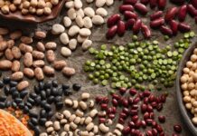
many types of foods, not just a few crops, such as rice, corn, soy, and wheat, but we’re
producing many different crops.
Brent Loken: We’ve got this resurgence of these ancient grains, maybe, that are
supporting local livelihoods. I think that those diverse systems where we walk onto a
farm and we see foods being grown, but we’re also seeing animals on the farm, a
diversity. Biologically rich places that we
know as supporting a thriving system of
Innovating
AgTech Bonus Episode Transcript
Page 5 of 16
What
will agriculture be like in 100 years?
animals and people, right, all in that one place. That’s what I’m hoping farming systems
can actually look like.
Hannah Senior: Pete Nelson, the founder of the U.S. AgTech accelerator, AgLaunch,
also considers diversity, especially of crops, to be an important factor in the coming
years, while serving the reminder that even giants can be toppled in time.
Pete Nelson: If you close your eyes and you imagine some of the things that, when we
see them or we read them in a book, there’s no futuristic ag-book that has the whole
puzzle, but there’s some that have good pieces of the puzzle. We’re going to have a
much larger subset of the 32,000 potential plants where we grow obviously six, now,
that provide most of the caloric intake globally. And think about a hundred years from
now, we’re going to have 2000 plants that provide that in a much more dynamic way.
Pete Nelson: If you think about growing systems ranging from really interesting sort of
inter-species to indoor agriculture, to appropriate automation on a field level. I think
again, no one-size-fits-all. A lot of dynamic enterprises with a bunch of different scales
and different outputs. All of that will centre into a way of measuring sustainability, and
monetizing sustainability and data in a very different way that we think about it now.
We’ve got the famous slide now that shows a big X through Sears because they’ve
been fundamentally disrupted by groups like Amazon. A lot of the players that seem
strong now won’t exist a hundred years from now and which is an interesting thing to
think about.
Hannah Senior: The FAOs Francesco Tubiello considers system efficiency and
integrating new production techniques closer to urban areas to be important goals for
the coming generations.
Francesco Tubiello: In a hundred years from now, if we’re there, it’s because we’ve
solved these problems correctly, to some extent.
[He laughs] I have a vision of, in
Innovating
AgTech Bonus Episode Transcript
Page 6 of 16
What
will agriculture be like in 100 years?
agriculture, a system that addresses many of the problems that we have today.
Therefore, I would like to think of production systems that are closer and more closely
integrated to urban areas. Maybe also some urban agriculture and vertical farming,
which we didn’t touch, which is still a possibility.
Francesco Tubiello: So, a system in any case that is much more efficient, not only in
how the land is used to produce food, but also in terms of its connection to the people,
distance, avoiding what we do today, right? Destroying an ecosystem somewhere in a
far away tropical country.
Francesco Tubiello: And if I may add, because we didn’t touch, we talk about
agriculture and we always miss on the ocean, the sea part, right? I mean, fish being
such a large provider of proteins. I do expect that probably we’ll be able to have
modern, more efficient system that take advantage of marine production a lot more and
better than we do today.
Hannah Senior: Journalist and author, Sarah Mock, wants to see farmland return to a
system of common ownership in the decades to come. But she also believes that
climate change has likely already sealed many of our fates.
Sarah Mock: I think we probably will be on a pretty severe path, climate change wise.
So, we’ll be experiencing significant disasters kind of all the time. I don’t know, but I also
think we probably will have adapted. Hot take perhaps – I don’t think we’ll be talking
about climate change that often. I think it will be kind of a moot point of facts that we just
all accept and we will be moving onto other… You know, like fighting wars over water
because there just is none in the west, figuring out how to desalinate salt water in an
actually effective way. Actually, using waste water is much more effective than
desalination but, we’ll all be drinking recycled water. Maybe the way we create or use
waste will be significantly different. That’s not a very bright idea without exogenous
factors that I could not possibly predict.
Innovating
AgTech Bonus Episode Transcript
Page 7 of 16
What
will agriculture be like in 100 years?
Sarah Mock: I don’t really know how you would guess that some big change would
happen. But ideally what agriculture would look like in 2121, the vast majority of
American land in a common system. Like use-based access to farming, basically. If you
want a farm and you are good at farming and you can put together a farm business, you
can gain access to farmland. It cannot be held as an asset class. It cannot be held as
an investment class. It is publicly owned and as soon as your ability to use it as an
individual, as a group, lapses then it goes back into the commons.
Sarah Mock: I think we’ve missed the boat mostly on not having significant impacts
from climate change. We will, maybe, have migrated back from the coast. No one will
live in New Orleans, but people can live in Baton Rouge on their ocean front property.
No one will be able to live in Virginia Beach but people in Richmond will have really nice
oceanfront property. Florida, maybe just a net loss. California, tough. But who knows,
maybe we will have stopped exporting all our alfalfa from the central valley to Saudi
Arabia so we can actually grow food for people there.
Sarah Mock: Wyoming will somehow become like a bread basket state because of how
climate change is likely to shift. I think there is a world where we are dealing with such
severe refugee crisis from central America, that will be a big thing that we’re dealing
with, just finding places for relocated people and the idea that people will still be able to
hold massive amounts of land while tens of millions of refugees are flooding into the
country is kind of comical. So, maybe that’s the thing that will upset the current land
tenure system and change agriculture.
Sarah Mock: I still believe either way that we’re likely to not really be talking about it in
a hundred years. We will either have accepted it or we will have done enough about it.
Either way, we’re going to accept it, humans move on pretty quick. Right? We rode
horses into battle in 1920, basically, and then we put a man on the moon in 1969. So, in
40 years we went from animals to rockets and I think we can adjust to floods and the
Innovating
AgTech Bonus Episode Transcript
Page 8 of 16
What
will agriculture be like in 100 years?
loss of coastal land, and probably even the death of millions of people, which is pretty
heartbreaking. Who knows? Maybe America will split into different countries. A hundred
years is a very long time to predict! [She laughs]
Hannah Senior: Ben Honan, at Amsterdam’s Climate-KIC, believes hints about where
we’re going are seen in a concept of future living provided by a company called
Superflux.
Ben Honan: A hundred years. Oh, that’ll be quite interesting. You know, there’s this
really interesting couple and they run Superflux, which is like futuristic environments.
They have a literal apartment that’s built a hundred years into the future, and there’s a
kind of washing machine that’s been pulled apart and repurposed as a herb-lettuce kind
of factory. So, in the absence of having thought about that more seriously, I would say,
or go Google “Superflux” and look at their future apartment and at that little washing
machine gadget.
Ben Honan: Because I think that there will be very high-tech, very local, very
personalised agriculture that is super low emissions and, somehow, also customised to
you and your genetics in a way that tries to make it better. I think we will be quite far
from the massive corn fields of America and the wheatbelt of Australia as well.
Hannah Senior: Kimberley Ansell, from new Zealand’s Te Hono, considers that future
disruption in the supply chain will shift consumer behaviour and expectations about
food.
Kimberley Ansell : There’s a whole lot of disruption going on with supply chain and I
feel personally it’s going to be a real mix of those traditional foods, albeit probably going
to really much more high end premium consumers who can afford to pay for this
particular cut of beef or this type of venison, and then all those other kind of futuristic
foods. So, the plant-based proteins, those cellular agriculture.
Innovating
AgTech Bonus Episode Transcript
Page 9 of 16
What
will agriculture be like in 100 years?
Kimberley Ansell : I think there’s a lot of consumer push for nutrition, and there’s all
sorts of teas for skincare, and there’s really interesting stuff that’s coming out there that I
just don’t think we can really forecast until they turn up. I think that key things are
around environment, traceability, having authentic stories from where this produce is
coming from, and then that whole overlay of technology and how consumers actually
interact with their food and fibre, and the products that they’re actually consuming or
purchasing.
Hannah Senior: Juliet Ansell, no relation, Head of Global Science Innovation at the
Kiwi fruit company, Zespri International, foresees a heavy focus on zero waste and
vertical growing techniques for many crops and food stuffs. But she doesn’t envisage
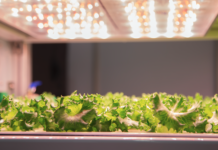
outdoor growing being replaced altogether.
Juliet Ansell: I hope, because I think about this a lot, we’re going down a track of very
high tech, very precision horticulture. But I hope that there is still outdoor farming
agriculture. I think there’s always going to be a place for naturally-grown in the
environment, that really beautiful provenance of a healthy product.
Juliet Ansell: So, I think we’ll go two ways and I think that possibly would be the
premium brand. You know, “this was grown outdoors in New Zealand or in Italy”. But I
think we’ll also have this split where there’ll be the really high tech, grown close to
market, vertical, absolutely circular in terms of water and nutrients, only what’s needed
at exactly the right time to get to this fantastic quality because we have to feed a large
number of people in the world.
Juliet Ansell: To me, I think that’s where I would see it going, we’d do both really well.
And unfortunately, I think the land, the value of land and the way it’s being eaten up by
people, puts the outdoor one at risk but I would really hope that it’s there in the future
still. I mean, this is the thing. You can’t keep on using the land and not putting
something back into it. The way that we grow Kiwi fruit is actually already very much in
Innovating
AgTech Bonus Episode Transcript
Page 10 of 16
What
will agriculture be like in 100 years?
the regenerative horticultural practices because we know that you can’t just keep taking
out of the land. So, the indigenous people in New Zealand, the Maoris, actually have
much, much longer vision in terms of their business planning for the people and for the
land. They have 50 or a hundred year business plans because they understand that you
are looking after the land for the future generations.
Juliet Ansell: And I’d say that’s a theme that goes through a lot of Kiwi fruit growers as
well. Replanting, protecting the waterways, thinking about what agrichemicals we put on
and what we don’t. So, it’s about the land but it’s also about the community around that
land, keeping them safe. I mean, sustainable in the true sense of the word that it’s going
to be here in a hundred years.
Hannah Senior: Ethan Cleary, however, can see a future that allows farming without
stepping foot on the farm but recognizes that marrying technology with
multi-generational farming knowledge and instincts, will still be essential.
Ethan Cleary: A hundred years. I don’t know. I think there’s a lot of hype at the moment
around the metaverse and having all of these kind of persistent online kind of
existences happening. I could see that there will be that element of it. No matter where
you are in the world, you’ll be able to step into your fields, have a look around. You’ll be
able to run enhanced predictions, projections. You’ll be able to kind of do diagnosis
completely remotely. You’ll be able to multivariate test before you even put a seed in the
ground or, before you buy a livestock unit, you’ll be able to actually see the progeny
going forward and see the heritage going backwards. I think it’ll be very different than
what we have now, but people still need food and it’ll always be there.
Ethan Cleary: People said that horses will be gone but horses are now a pastime and
we still see the nostalgic look at people coming out in their horse and cart, going into
McDonald’s and stuff here. So, I think there will always be a place for certain elements
of agriculture, but I think the majority will have moved on into a pretty unrecognisable
Innovating
AgTech Bonus Episode Transcript
Page 11 of 16
What
will agriculture be like in 100 years?
kind of approach. There’s a lot of farming in offices done now but I think that tradition is
there. The big thing that we try to do, particularly with the digital education, digital skills’
thing, is that you have to marry tradition, the wisdom of previous generations, with the
skills and the tools that are coming from newer generations.
Ethan Cleary: I know myself, I love nothing more than getting out and walking in our
fields. It’s a sense of something that connects you, going back generations. So, I don’t
know if that will ever be replaced, that type of feeling. But maybe in the evening when
you’re done your manual task, well, it’ll probably all be automated, then you could
possibly go in and future-project or do your multivariate testing as well. I still think
walking out into a field or going up and putting your hand around your best milker, it’s
unbeatable. It’s why farming is… Unless people have done it, won’t understand the
connection that’s there.
Hannah Senior: David Smith, founder of livestock GPS tracking company, Ceres Tag,
considers data to be the crop of the future.
David Smith: Oh, I think it’s going to be as much about data as the actual products that
are produced. I often say, when you buy a cow, you get the cow thrown in for free. What
you’re buying is the data.
Hannah Senior: A similar theme is picked up by Bethany Deshpande, CEO of the dairy
tech company SomaDetect. She also considers a focus on data to be essential to the
future of agriculture.
Bethany Deshpande: A hundred years from now, we will have at least another few
billion people on the planet. I think that we are living at a time, also with regards to
climate and everything, where doing things sustainably is absolutely critical. I think data
is one of the things, or monitoring is one of the things, that’s going to help us get
Innovating
AgTech Bonus Episode Transcript
Page 12 of 16
What
will agriculture be like in 100 years?
smarter, better over time and hopefully more efficient in how we make our food and
raise livestock.
Bethany Deshpande: In terms of what I see, that is absolutely critical and really
automating that process as well. Even on a dairy, already we see a lot more jobs that
are more engineering focused, or that are way more data focused than maybe they
used to be. Getting that computer science level talent, engineering level talent, at the
farm and really helping to do what is needed so that we all get more efficient at these
various things, I think will probably be one of the biggest changes we see from now to a
hundred years.
Hannah Senior: Another AgTech entrepreneur, Ashwin Madgavkar, founder of Ceres
Imaging, expects automation and precision farming techniques to take centre stage for
future farmers, to help them battle the effects of climate change.
Ashwin Madgavkar: I think agriculture will be farmed at a plant level. Right now, people
make decisions on fields which are, depending on the crop, thousands, tens of
thousands, hundreds of thousands of plants and they’ll make a blanket decision there. I
see the world where we’re putting the right amount in the right place at the right time for
truly precision farming. That’s really going to be enabled by technology.
Ashwin Madgavkar: That’s going to make the sector far more sustainable because I
think weather variability and climate change
is only going to amplify a lot of the
shortages and effects that we’re doing right
now. It’s also going to make it more
productive and it’s going to make it more automated. These decisions will feed into a
tractor, or a robot, or a driverless tractor, or whatever that’s going to go and apply that.
It’s going to make precision farming at scale even easier and more automated than it is
today.
Innovating
AgTech Bonus Episode Transcript
Page 13 of 16
What
will agriculture be like in 100 years?
Hannah Senior: Agtech veteran, Adrian Percy, reflects on the sheer pace of change,
believing that in a century technology advancements will create virtually unrecognisable
farming practices.
Adrian Percy: Nothing like it is today. We will see much more technology. We will see a
completely digitised food system and we will see, I think, lower use of labour in the field.
A lot of those menial tasks that no one really wants to do going away and being
replaced by robots and other new equipment. I think agriculture will be largely grown
indoors or food will be largely grown indoors as well, in a hundred years. So let’s see. I
won’t be around then! [He laughs] but I’d love to find out and fast forward.
Adrian Percy: Standing in the way is probably the inheritance that we have, the
traditions that we have to a degree, the lack of really new thinking, the lack of new
technology or the available new technology. The fact that governments are not yet
sufficiently tuned into the needs of agriculture. So, a lot of hurdles to overcome.
Hannah Senior: We end with a Senior Investment strategist at UBS, Wayne Gordon,
who predicts that although much of farming in 2122 will be unrecognisable to us today,
we will continue to value the deeply embedded need for cultural and social practices
around food and eating.
Wayne Gordon: I think it’ll look vastly different in the sense that a lot more products will
be cultivated through cell-based agriculture, for example particularly in proteins. We will
become better at managing water resources simply because they would’ve become
scarcer.
Wayne Gordon: Having said that, I still think there is a significant place, and I use the
word traditional in more of a geographical sense, I think there are still significant
opportunities for broadacre agriculture to continue to conduct operations. Obviously not
as we see them today but not that dissimilar, with a lot more emphasis on data, data
Innovating
AgTech Bonus Episode Transcript
Page 14 of 16
What
will agriculture be like in 100 years?
management, to make key management decisions. There’ll be a lot greater focus on the
type of food we eat. Things like food for health reasons, the utilisation of food in
medicine. Those elements will actually embed agriculture more in the day to day life of
consumers than it does today. I think the consumer in the future will be completely
aware of where the food comes from, how that food interacts in its diet, how that food is
adding to the overall nutrition and health of our bodies.
Wayne Gordon: At the same time, we won’t lose the enjoyment for food. I think that’s
really key that while yes, we will produce cell-based agriculture and it will provide an
enormous amount of our nutrition that we consume every day, at the same time there’s
going to be a great uniqueness still about buying wine from Burgundy, and so forth. You
know, of course, a lot of this is predicated on us making significant inroads into the
mitigation of the changes in our climate, the mitigation and an adaptation to what will be
a changing climate over the next hundred years. But as food has been an immense
pleasure for thousands of years, it will be the same in that context, looking forward a
hundred years.
Wayne Gordon: How we produce that food and the type of products in which we
consume on a day to day basis clearly will change significantly, but we’ll still get a great
deal of enjoyment and pleasure out of where food is produced and how food is
produced, and the unique way in which many producers bring those products to market.
That sort of interaction between technology and, I guess if you can say, history and
provenance I think will become more embedded in how we look at food and agriculture
in a hundred years.
Hannah Senior: So, there we have it. Food for thought about future farming. A range
of views that strike me as exciting and sometimes alarming in equal measure. What do
you think agriculture will look like in a hundred years? What kind of future would you like
to create? Share your thoughts and tag me on LinkedIn or Twitter using the hashtag
Innovating
AgTech Bonus Episode Transcript
Page 15 of 16
What
will agriculture be like in 100 years?
#InnovatingAgTech, or contact me via agtechthinking.com. I look forward to hearing
your thoughts and thank you for listening.
[Theme music plays]
Innovating
AgTech Bonus Episode Transcript
Page 16 of 16
What
will agriculture be like in 100 years?
